
blah blah blah
Rogers Ledge and Unknown Pond
Length: 12.2 mile loopDifficulty (click for info): Very Hard
Elevation Gain: 2660 feet
Rating (click for info): 10/10
Elevation: 2965'
Prominence: 495'
Driving Directions:
Trailhead and parking area are on York Pond Road in Berlin, NH (summit is in Kilkenny). (Seasonal road - check status on TrailsNH to verify gate status). York Pond Road begins on the west side of Rt. 110 in Milan, 7.3 miles northwest of the junction with Rt. 16 in downtown Berlin and 3.9 miles southeast of the junction with Rt. 110A. Drive 5.1 miles down York Pond Road into the Berlin Fish Hatchery. As you approach the center of the hatchery you will pass through a gate with hours of 8:00AM-4:00PM, but is usually left open later for hikers. If you are uncertain about your return time, it may be best to park outside the gate and walk in. Shortly after passing the first pond, take a right onto a 0.2-mile spur road marked with a sign for Mill Brook Trail. Park near the kiosk at the end of the road. Click here for a Google map.
About the Hike:
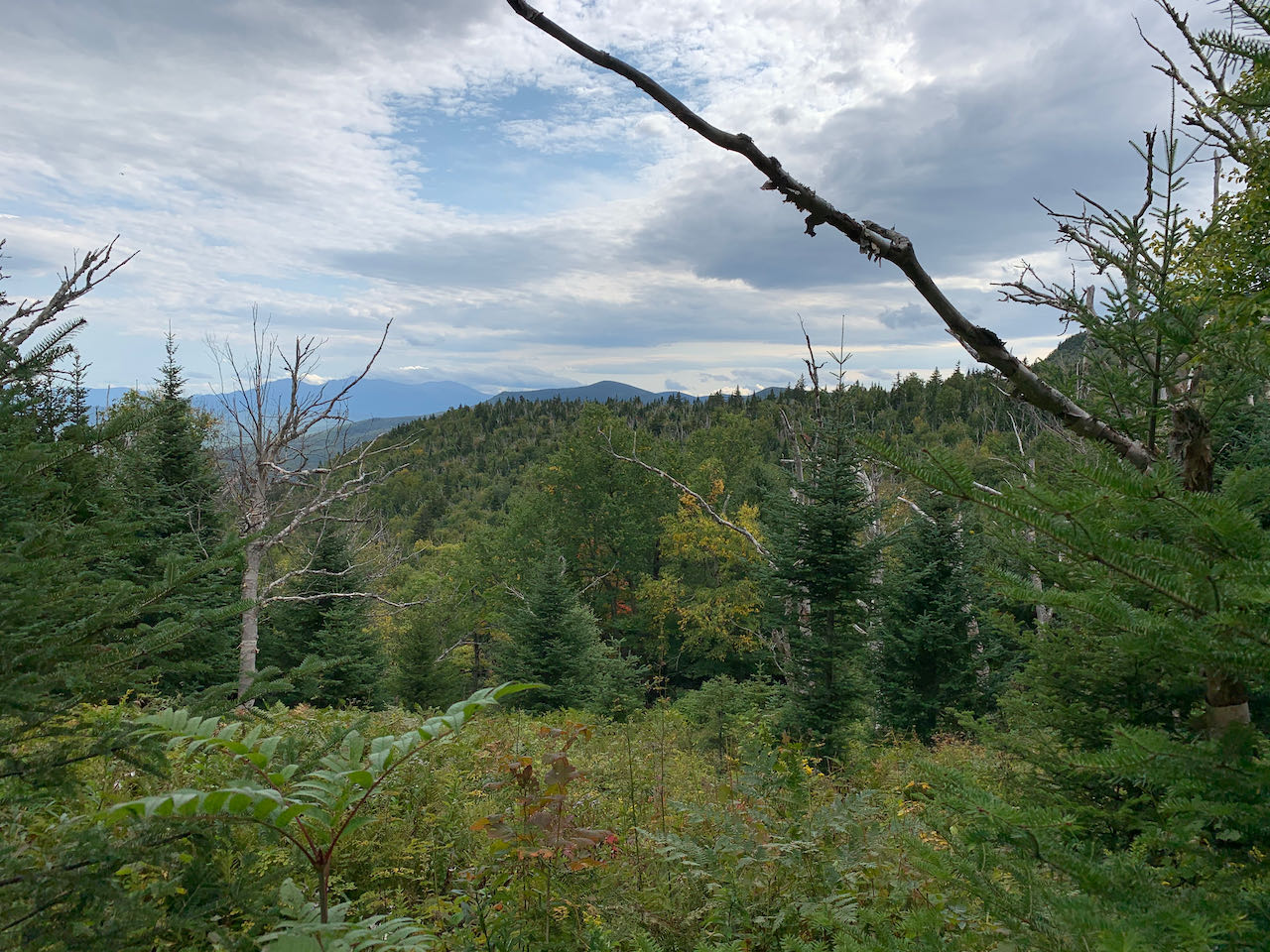
Rogers Ledge is a prominent knob on a long northwest to southeast ridge located in the northeastern wing of the Pilot Range. While offering stupendous views from its broad, table-like summit ledge, its isolation and northern locale make it a less busy peak for hikers. The 20+ mile Kilkenny Ridge Trail, which traverses the main ridge line of the Pliny and Pilot Ranges, makes a stop on its summit, giving Rogers Ledge one of its two main uses, namely as a point along the two or three day journey of Kilkenny traversers. The other popular reason for visitors is its recent inclusion on the 52-With-a-View hiking list. The fantastic perspective of the north country from the summit was certainly worthy of its joining the roster of our state's best viewpoints under 4000 feet. The Kilkenny Ridge Trail provides two approaches to the peak; we have described the more scenic southern route here, which explores lush northern forest along the banks of whimsical Cold Brook before ascending through scenic birch glades to the summit. This route also includes an additional loop out to secluded Unknown Pond, which offers picturesque shoreline views of the Horn. On the way over, you will pass by scenic Kilback Pond, another remote mountain waterbody with nice views.
Begin your hike at the Mill Brook Trailhead in the midst of the Berlin Fish Hatchery. From the parking area, walk up the dirt road toward a small water supply pond and turn right across the grass, passing between a brown shed and a fence around the near side of the pond. Look for a signpost on the other side marking where Mill Brook Trail enters the woods. Stroll through tall spruces, then approach Cold Brook, your companion for the better part of the hike. The brook is alternately steps away and through a stand of trees as you ascend gradually into the valley between Deer Mountain and Unknown Pond Ridge. The footway is narrow, as the trail receives only modest use, and often has lush vegetation all around, especially when the scenic birch trees mix in. Around 0.85 miles, the trail hugs the brook and swings right as the valley walls steepen. In this section, several small tributaries are crossed as they tumble into Cold Brook. In another 0.4 miles, the trail drifts uphill away from the brook and later passes through several marshy openings in the forest where tall grasses obscure bog bridges. Climbing is exceedingly gentle for the next 3/4 mile as the trail continues to accompany the brook through gorgeous northern forest scenery. After this relaxing stretch, at around 2 miles into the hike, the trail swings uphill, parting ways with the brook, winds around a small knoll, and descends briefly to skirt another marshy area 0.3 miles after leaving the brook.
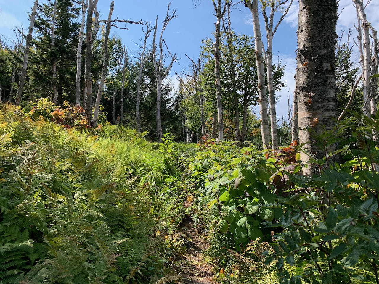
The trail now ascends easily in a the valley of a more minor brook, in darker and more coniferous forest. In just under a half mile, the path flattens out again. It's another half mile of easy terrain before hobblebush and ferns take over the landscape and the path angles downward again. Descend gently for just over 0.3 miles, entering an open forest, passing by a swampy area, and taking a few bog bridges to a trail junction with the Kilkenny Ridge Trail, the main thoroughfare in this region of the Whites. Take a right and begin ascending again, passing a side path to a campsite in 0.1 miles. The steepest climbing of the day is ahead, though even this can hardly be considered strenuous. The trail ascends moderately through fine open birch glades for the next 0.3 miles, passing a large boulder. The trail transitions out of the birch glades and soon makes a left turn at a plateau at the base of the distinctive summit cone. Tackle a steep, rocky pitch, then wind your way around the northeast side of the summit block, passing beneath an impressive cliff face. Pass through a brushy section and swing left again, climbing steeply past a window in the trees that allows for a slight view north. Just a bit more climbing takes you to the summit, where several campsites are scattered. There is a ledge with a view straight ahead, but veer downhill to the right to follow the spur path out to the large table-like ledge which is the main attraction of the summit.
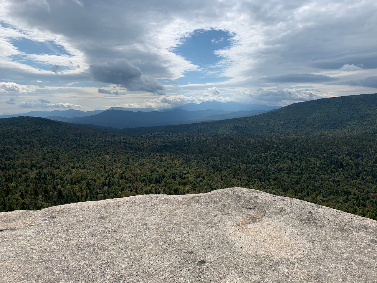
The rock offers plenty of space to spread out and enjoy the scenery. Use caution, as the cliff drops abruptly at the edge of the rock. To the left, the view stretches a distance over the Androscoggin River Valley to the high peaks of the Mahoosuc Range. The terrain below the ledge stretches out to a rounded shoulder, behind which and to the right are the peaks of the Carter Range, with Carter Notch visible. The Crescent Range stretches out in front of these. The high Northern Presidentials are also in full view further over. The main feature straight out from the ledge is nearby Unknown Pond Ridge, which takes up most of the view to the southwest. The Horn pokes up behind the right side of the ridge, with the summit of Mt. Cabot hidden. The northwestern wing of the Pilot Range, including Hutchins Mountain, extends off to the right. Enjoy your time on this remote gem of a summit.
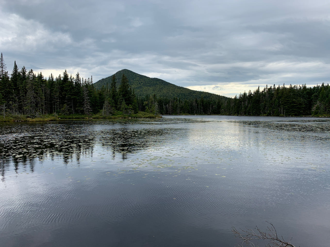
To continue on the extra loop, retrace your steps back to the junction with Mill Brook Trail and continue south on the KRT. Shortly cross a small stream that drains from the plateau and climb for about 0.15 miles before the trail levels off and meanders through a lush, swampy area. Watch out for potentially muddy stretches for the next 0.4 miles through the moist, dark forest before arriving on the boggy shores of Kilback Pond. The trail crosses the north end of the bog, with a view over to the water, then winds through a strip of woods between two watery areas. The best scenery is found at the log bridge on the northwest side, where you can observe the whole of the quiet waters, with views up to Unknown Pond Ridge, rising as a backdrop. As you meander away from the pond, the trail continues alongside the extensive wetland, and crosses another log bridge in 0.1 miles. Look to your right here to glimpse the towering cliff of Rogers Ledge. The trail heads back into pleasant forest and climbs a rather steep pitch followed by a flat section, repeats this process a second time, then begins to ascend the true slope of Unknown Pond Ridge after 0.4 miles. The going is moderate at first, and tall hobblebush soon begin to crowd the pathway. The climbing steepens as the trail transitions into lovely birch glades, with occasional views through the trees. The glades span much of this side of the ridge and go on for quite a while. The trail levels off and crosses its height of land after 0.6 miles of climbing. The summit of this ridge is a quarter mile off to the left, and is tucked away in some of the most stunningly beautiful birch and fern glades to be found anywhere in our state, but this is accessible only to those familiar with off-trail navigation. An equally interesting stop for bushwhackers is the slightly lower north summit of the ridge, on the opposite side of the trail, where there are views to the north from more birch glades, and a hidden ledge viewpoint overlooking Unknown Pond and offering excellent views of the Carter and Presidential Ranges and Mt. Cabot. The trail now drops off the opposite side of the ridge and descends moderately for just under 0.4 miles, passing several campsites near the end, to a trail junction close to Unknown Pond.
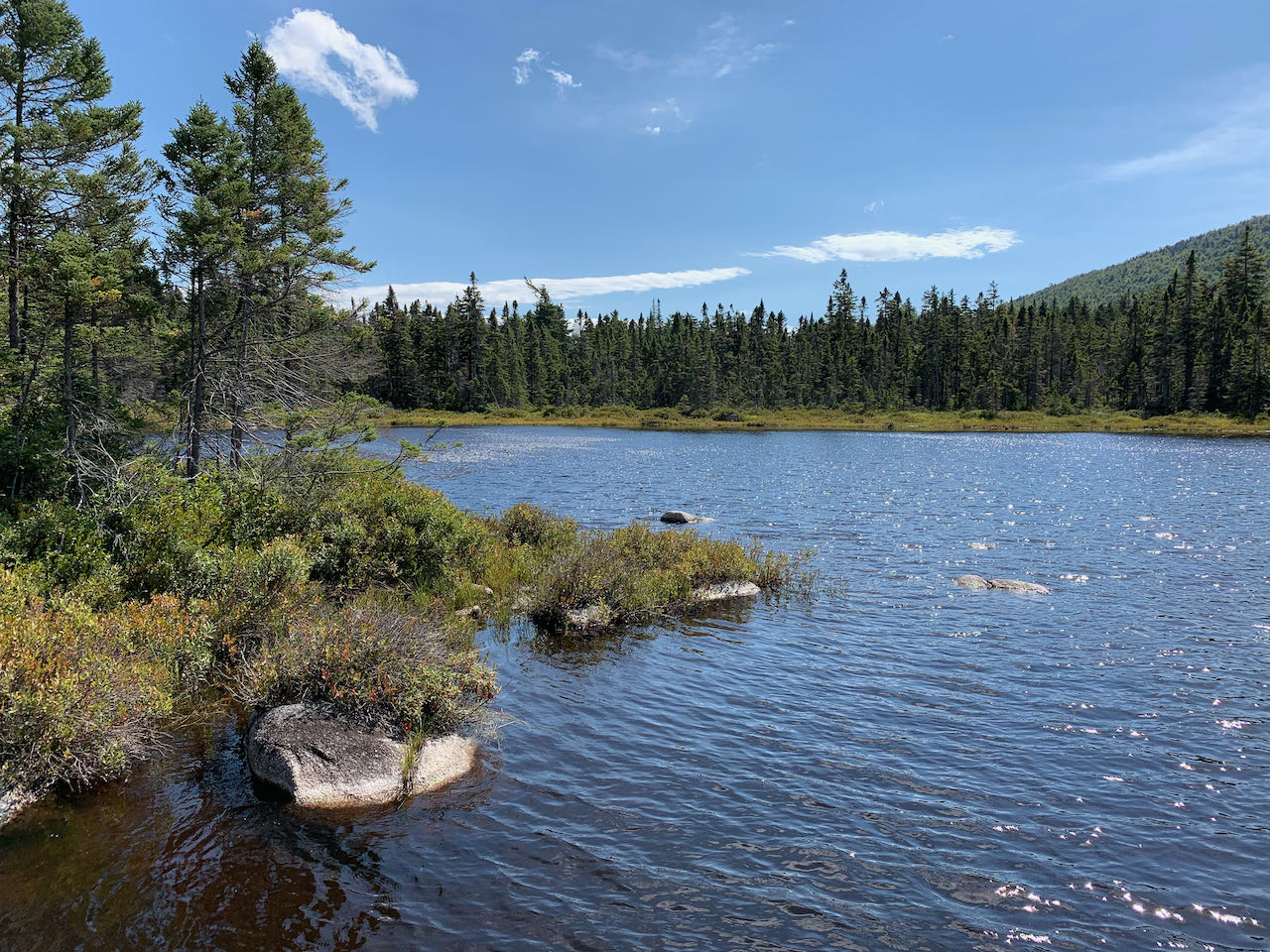
Take a left onto the Unknown Pond Trail. A quick spur path down to the waterside allows observation of the reflective pond, with its enchanting view of the Horn. Lily pads dot the surface of the water. The trail follows the shore of the pond for 0.1 miles, passing a spur to a campsite on the left, then leads by the marshy outlet. It then begins to descend through yet more intermittent birch glades, with some views of the Presidential peaks. Alternating with rocky footway through the forest, these scenic openings bloom with asters and flow with springs. The trail eventually leaves the glades and lessens it inclide as it leads across the hillside further down into the valley. About half a mile from the end of the pond, the trail approaches the nameless outlet brook. Follow it closely through open woods for 0.4 miles, then cross the brook. In another 0.2 miles, the trail makes a quick one-two crossing of a small tributary and then the main brook on large stepping stones. The trail continues down at increasingly easy grades, generally following the brook for 1.4 miles before finally pulling away. In the final 0.4 miles on the trail, you cross a marshy area with some bog bridges, and pop out into a logging landing at the trailhead. The final section of the hike is a two mile road walk to return to the Mill Brook Trailhead. Walk all the way down York Pond Road, curving around York Pond, and turn left back up the short spur road to the parking area.
Printable directions page